Introduction-
This week's lab was focused on flight preparation and readiness. Planning a flight is not done at the site, but in the office. The mobile app Measure Ground Control (MGC), and the website of the same name, were used in this lab to utilize all aspects of mission planning in one program. This will keep the planner's desktop neat and organized, ultimately preventing lost data or confusion. Inefficiencies with data collection or data storage has been such a problem in the UAS industry that many companies specialize in Single Source of Technology Solutions (SSoT). Measure Ground Control is one of these SSoT companies that are capable of checking the air space for no fly zones or advisories, and creating a flight mission for the site without being there. Having these capabilities is very useful for the UAS world because it keeps all preflight information in one area, outside of your field notes. When the mission planning is complete, the app is then used to connect and monitor the UAS during operation. It allows the pilot to observe the flight in FPV, along with flight metadata. This is the most efficient way of tracking data throughout the preflight, inflight and post flight operations.
Overview-
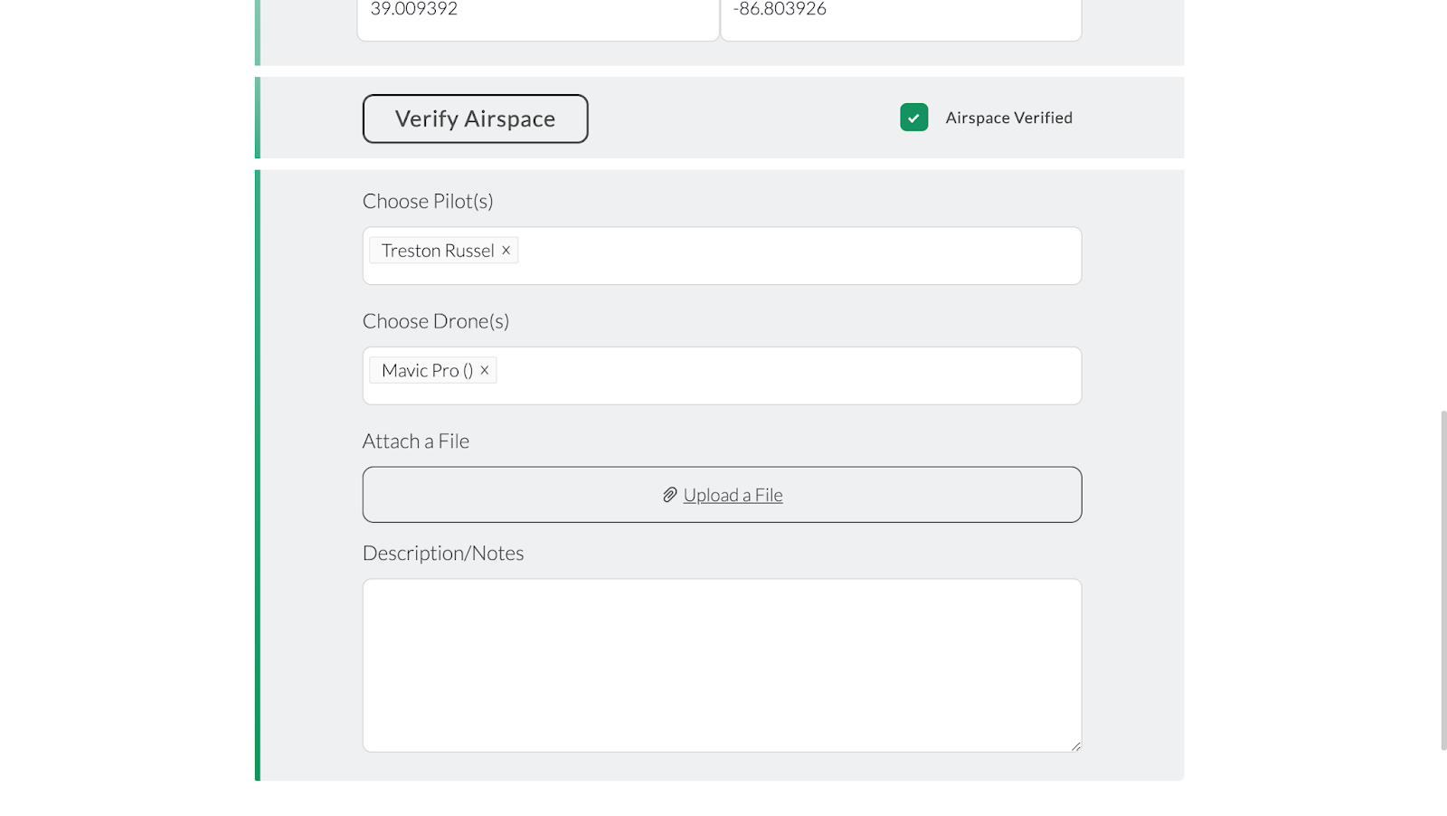
Before creating a flight plan on the app a mission has to be created and shared onto your profile, and is available for preflight planning. Figures 1 and 2 represent the basic setup of creating a flight mission. This details the mission name, date, type, location, pilot and airframe.
 |
| Figure 1: First half mission setup |
 |
| Figure 2: Second half of mission setup |
After the mission is created the planning process continues on the website. The first thing to check is the airspace in which you plan on operating. If you are within restricted airspace or any other airspace a part 107 operator can not fly in, then you need to seek permission for flight. Figure 3 represents the Airmap provided by the MGC app, the website does not look much different. Figure 4 and 5 represent the grounds when checking Airmap at Purdue campus and the Purdue Wild Life Area. The Purdue campus area shows a no fly zone due to the class D airport nearby, whereas the Purdue Wild Life Area is outside the class D airspace.
 |
| Figure 3: MGC Airmap |
 |
| Figure 4: Purdue campus Airmap |
 |
| Figure 5: Purdue Wild Life Area Airmap |
Once the Airmap is consulted, and permission is given if needed, the flight planning begins remotely. The site is observed from the MGC Airmap for the best flight path, as shown in figures 6 and 7. The flight path is then created in flight planning, shown in figures 8 and 9. Once the flight path has been chosen, the mission can be shared onto your profile for the flight team to conduct the flight. When the flight team arrives on site, they can refer to the MGC for any updates on advisories in your area. After checking the advisories, weather and preflight checks, the operator is then able to make adjustments to the flight path if needed. Changes like adjusting the physical path the drone will be following, changing heights, speeds and time of flight could be done within the app due to the topography or other objects in the way that were not observed in the planning portion. These possible changes are demonstrated in figure 10. This is a major help to the efficiency of UAS operation due to being able to change features on the fly in one application, rather than having to set up a major ground station or aborting the mission to return to the office to make the changes. The pilot can then start the mission, after making appropriate changes, and monitor in FPV all of the data being collected. Once the mission is completed the data is then uploaded to the website in the operators mission profile.
 |
| Figure 6: MGC Airmap site exploded view |
 |
| Figure 7: MGC Airmap site close view |
 |
| Figure 8: MGC flight planning |
 |
| Figure 9: MGC final flight planning |
 |
| Figure 10: MGC app finalized mission adjustments |
Conclusion-
In conclusion mission planning is one of the most important processes in executing a UAS flight mission. Having one place to keep all information created or collected betters the overall efficiency of the UAS data collection operation industry. This is why it is important to utilize SSoT applications to keep everything organized and easily accessible for the operators, planner and modelers. Not only is having the data collection and planning all in one place very important for efficiency, but incorporating the mission execution portion of the operation in the same application increases that efficiency.