AT 409: Field Report Week 12
Aaron Varnau, Treston Russell, Tristan Bungen
Mission Statement:
Crew 3 will use our knowledge, attention to detail, and teamwork to successfully complete this mission to the best of our abilities.
Mission Purpose:
The purpose of our weekly flights is to monitor and record the changes that happen to the trees in the Northwest and Northeast plots at Martell. This research is being done to assist the Purdue Agricultural department and their research. This research is also being done to show the usefulness of the UAS department and give the department a strong reputation for great research. Other research is being conducted to help a graduate student William Weldon with his research thesis on finding missing persons.
Mission Location Summary:
Martell Forest was acquired to provide research and outdoor lab teaching opportunities close to the West Lafayette campus. It is named for Dr. Eldred R. “Shorty” Martell, who was head of Purdue's Department of Forestry and Conservation, now known as the Department of Forestry and Natural Resources, from 1940 to 1957. It was originally called Shidler Forest after the family the land was acquired from. Throughout its history, the forest has been central to the education of hundreds of natural resource professionals as well as a center for diverse research activities.
Martell Forest is the site of the John S. Wright Forestry Center, a research, teaching and conference facility located at 1007 N 725 W, West Lafayette, Indiana.
Acquisition date: 1958 (additional tracts acquired up to 2008)
Total acres: 477
70% forested
21% plantations
12 acres of prairie
2.4 acres of open water
2.6 miles of stream
4.5 miles of road
Credited Source: https://ag.purdue.edu/fnr/Pages/propmartell.aspx
Martell Plot Maps:
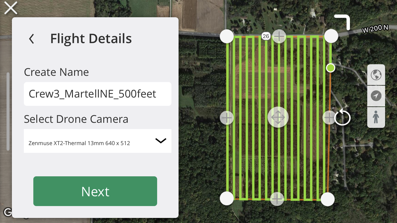
NE Martell Plot
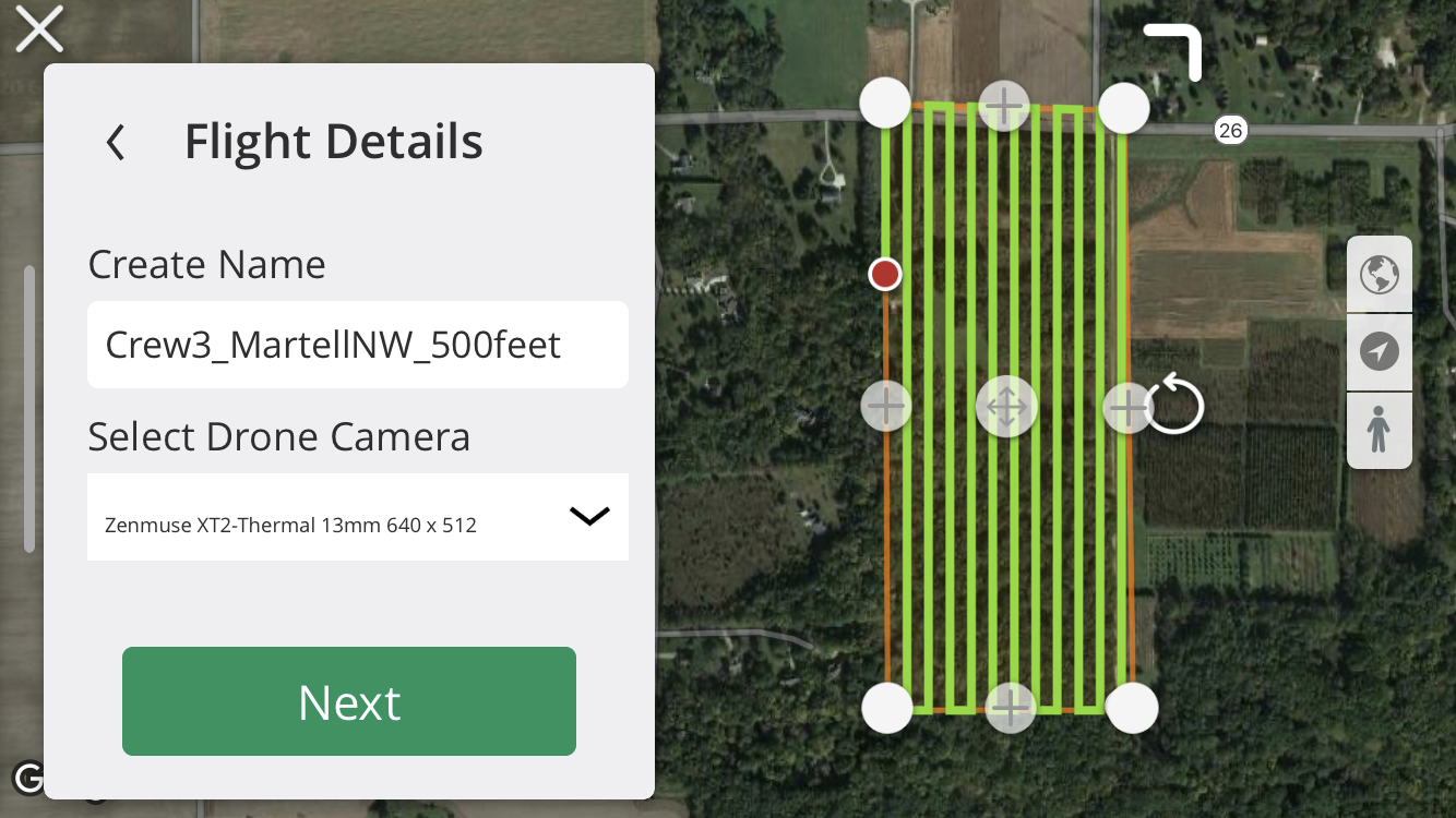
NW Martell Plot
11/13 Flight Report
Given that Tristan and Treston had both been exposed to Covid-19 through their roommates, Aaron was the only crewmember available to fly this week. On Friday at noon, he met with Dr. Hupy and Zach at Martell forest to fly the plots for one last time this semester. They were already out with the Bramor and brought the M600, batteries, and landing pad, while Aaron brought the XT2 and the PPK. Tristan had originally gone to meet with everyone but was asked to return home for maximum safety.
We flew near the Bramor launch site, on the north end of the northeast plot. The landing pad was placed in the taller grass away from the gravel road and trees so that the M600 could takeoff and land without worry of crashes. The first flight over the northeast plot went as planned, but a small hiccup delayed the flight over the northwest plot. On the second launch, the aircraft simply hovered a few feet over the ground with the landing gear up. We decided almost immediately to lower the landing gear and terminate the flight followed by a full power cycle. We weren’t sure where the problem came from, but we decided to change the flight mode from P to A for the following successful flight. Measure had an issue connecting to the aircraft after power cycling but another two power cycles fixed the issue. The third flight conducted covered the northwestern plot and was as successful as the original flight over the northeastern plot.
Aaron returned the equipment he brought and moved the flight data to the class data folders directly after the flights so that Tristan could remotely process it.
Metadata
General
------------------
Location: Martell Forest
Date: 11/13/20
Vehicle: M600
Sensor: XT2, Zenmuse, A6000
Approval: NA
Flight Information
-------------------
Flight Number/Plot: 1 / NE Plot
Battery: Beige
Takeoff Time: 1:07 PM
Landing Time: 1:27 PM
Altitude (m): 152m
Sensor Angle: NADIR
Overlap: 75%
Sidelap: 75%
Loss of RC: RTH
Shutter Speed: 1/3200
Aperture: F3.5
Iso Setting: Auto
Dial Setting: Shutter Priority
Lens Setting: Infinity Focus, F-3.5
Notes: Great flight with no problems.
Flight Number/Plot: 2 / NW Plot
Battery: Green
Takeoff Time: 1:36 PM
Landing Time: 1:58 PM
Altitude (m): 152m
Sensor Angle: NADIR
Overlap: 75%
Sidelap: 75%
Loss of RC: RTH
Shutter Speed: 1/3200
Aperture: F3.5
Iso Setting: Auto
Dial Setting: Shutter Priority
Lens Setting: Infinity Focus, F-3.5
Notes: Great flight with no issues.
Weather: Overcast, Cloudy, Calm, Good Lighting
------------------
Coordinate System: NAD83 (2011) / UTM Zone 16N
Metar: KLAF 131343Z 32011G20KT 10SM OVC011 04/02 A3015 RMK AO2 T00440017
Temp: 40 degrees
Humidity: 60%
Precipitation: 15%
Clouds: Yes, Overcast
Wind: 8 mph
Crew
------------------
PIC: Aaron Varnau
VO: Hupy, Zach, Treston Russell
Submitter: Tristan Bungen
No comments:
Post a Comment